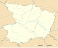
Ofbeeldienge:Maine-et-Loire department location map.svg

Afmetingen van deze voorvertoning van het type PNG van dit SVG-bestand: 726 × 599 pixels Andere resoluties: 291 × 240 pixels | 581 × 480 pixels | 930 × 768 pixels | 1.240 × 1.024 pixels | 2.481 × 2.048 pixels | 1.279 × 1.056 pixels.
Ofbeeldienge in een ôgere resolutie (SVG-bestand, nominaal 1.279 × 1.056 pixels, bestandsgrootte: 389 kB)
Bestandsgeschiedenisse
Klik op een datum/tijd om het bestand te zien zoals het destijds was.
| Datum/tijd | Miniatuur | Afmetingen | Gebruiker | Opmerking | |
|---|---|---|---|---|---|
| huidige versie | 10 feb 2018 20:16 |  | 1.279 × 1.056 (389 kB) | Sting | == {{int:filedesc}} == {{Information |Description={{en|Blank administrative map of the department of Maine-et-Loire, France, as in January 2018, for geo-location purpose, with distinct boundaries for regions, departments and arro... |
Bloadn met dizze ofbeeldienge
Geen enkele pagina gebruikt dit bestand.
Globaal bestandsgebruik
De volgende andere wiki's gebruiken dit bestand:
- Gebruikt op als.wikipedia.org
- Gebruikt op de.wikipedia.org
- Gebruikt op eo.wikipedia.org
- Baugé-en-Anjou
- Saumur
- Angers
- Cholet
- Chemillé
- Ŝablono:Situo sur mapo Francio Maine-et-Loire
- Segré
- Baugé
- Saint-Martin-de-la-Place
- Angers-Saint-Laud (stacidomo)
- Saumur (stacidomo)
- Cholet (stacidomo)
- Angers-Maître-École (stacidomo)
- La Possonnière (stacidomo)
- La Possonnière
- Tiercé (stacidomo)
- Tiercé
- Saint-Florent-le-Vieil
- Mauges-sur-Loire
- Saint-Mathurin (stacidomo)
- Saint-Mathurin-sur-Loire
- Loire-Authion
- La Bohalle (stacidomo)
- La Bohalle
- Chalonnes (stacidomo)
- Chalonnes-sur-Loire
- Chemillé (stacidomo)
- Chemillé-en-Anjou
- Écouflant (stacidomo)
- Écouflant
- Angers-Saint-Serge (stacidomo)
- Champtocé-sur-Loire (stacidomo)
- Champtocé-sur-Loire
- Les Rosiers-sur-Loire (stacidomo)
- Les Rosiers-sur-Loire
- Gennes-Val-de-Loire
- Ingrandes-sur-Loire (stacidomo)
- Ingrandes (Maine-et-Loire)
- Ingrandes-Le Fresne sur Loire
Globaal gebruik van dit bestand bekijken.


